| A1 - Central District (8) |
| A1 - North of Francistown (4) |
| A2 - West (0 Poles) (3) |
| A2 - West (1 Pole) (3) |
| A2 - West (2 Poles) (5) |
| A3 - Nata to Francistown (6) |
| A32 (3) |
| A33 - Crop Fields (2) |
| A33 - Newly Paved Section (4) |
| A33 - Road Construction (4) |
| A33 - South Section (4) |
| A35 - East + West Poles (3) |
| A35 - East Pole (3) |
| A35 - Villages (3) |
| A35 - West Pole (5) |
| Area Code - Francistown (4) |
| Area Code - Gaborone (6) |
| Area Code - Maun (3) |
| North Border - Chobe River (2) |
| North Maun - Unpaved Road (5) |
| Shoshong Hills (4) |
| South West - Border with South Africa (6) |
| Tsodilo Hills Road (4) |
| West - Charleshill to Ncojane (4) |
| West - Non-Paved Roads (10) |
Meta List - A Learnable Botswana
A1 - Central District
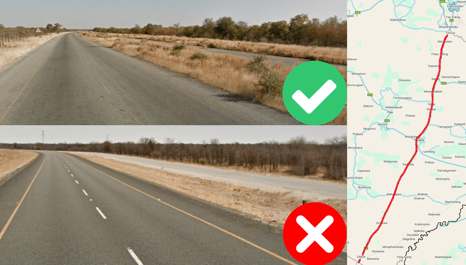
The section of the A1 within the Central District (Dibete to Tonota) has a parallel paved road the entire way, which is not in use or painted with road lines. Parallel roads are basically only found on the A1, and this section is distinguishable from the A1 north of Francistown because it is not newly paved/painted.
The map does not show the parallel road in the south of this section, so remember it stretches across the entire Central District if you are trying to pinpoint.
Check out www.plonkit.net/botswana for more clues.
Images:
